
![]()
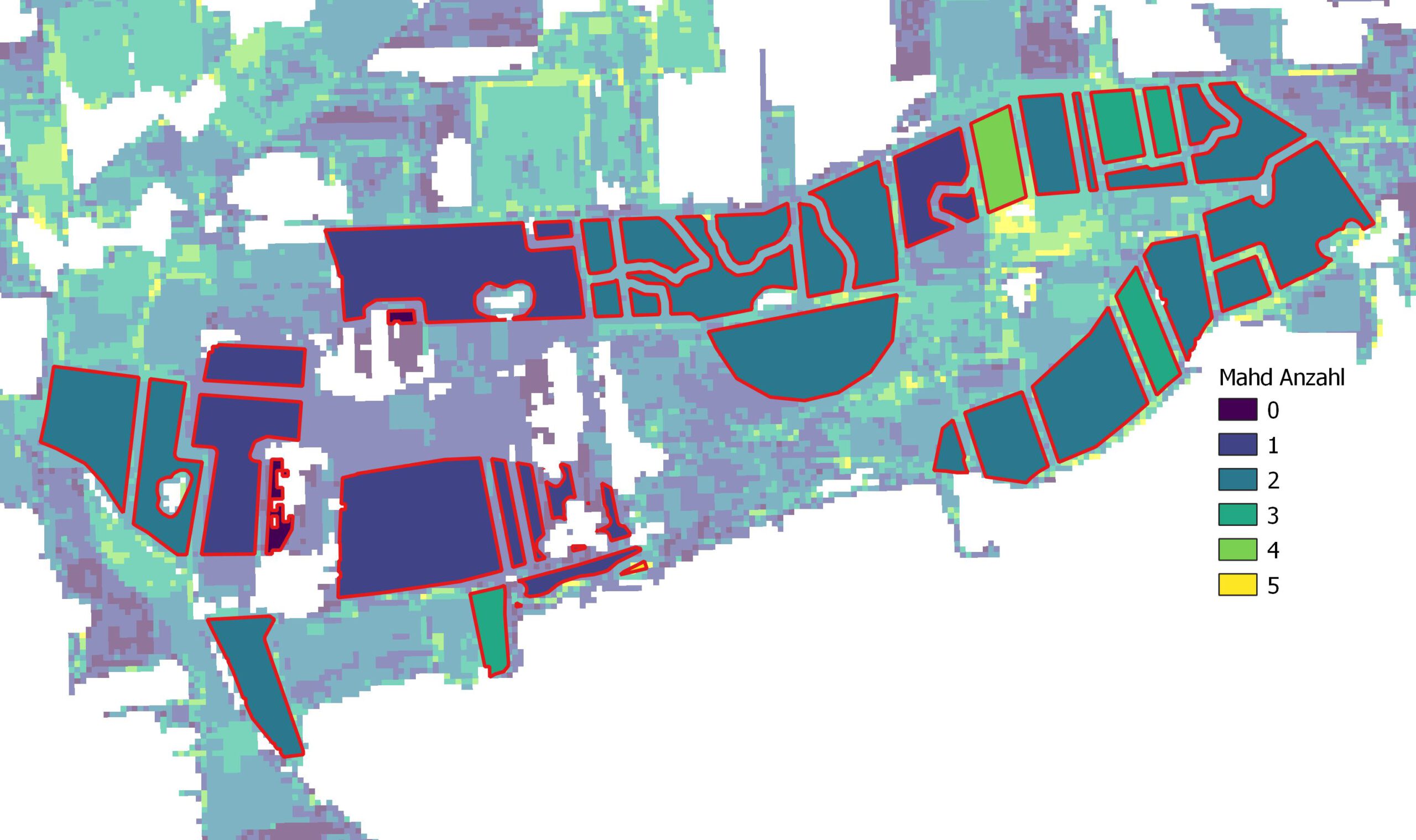
As a lighthouse project, CopGruen provides various services based on satellite data. The results are intended to support tasks in the field of environmental protection and nature conservation and can also be used without remote sensing expertise.
The services cover the following topics:
- Mowing
- Opeen Soil
- Mown meadows
- Waterlogging
- Heath encroachment
Integration into the services:
Biotopes Waterlogging